Today, it would not be a surprise if Korea has made its way onto the list for countries with the best transportation systems in the world. The country provides extensive networks of railways, highways, and bus routes; and there are numerous navigation tools to help travelers utilize Korea’s transportation grids efficiently.
My personal preferences for the mapping platforms in Korea are ‘Naver Map’ and ‘KaKao Map’. While they both are highly precise; however, I have recently started to lean towards the former since it is more up to date than the latter in terms of records of places that ran out of businesses. And not to mention that Naver Map is the only Korean transportation mobile app that is now available in multiple languages.
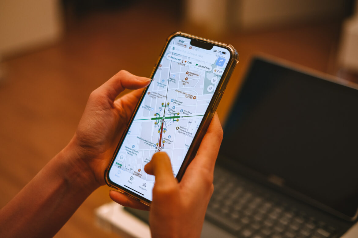
If you have seen some of my introductory posts about places in Korea, you might notice that I have always included Naver Map navigation hyperlinks at the end of each post to help readers with a matter of locations. In this article, I am going to provide you with a guideline on how to use the app-based Naver Map for your smoother journey in Korea.
1. Download Naver Map
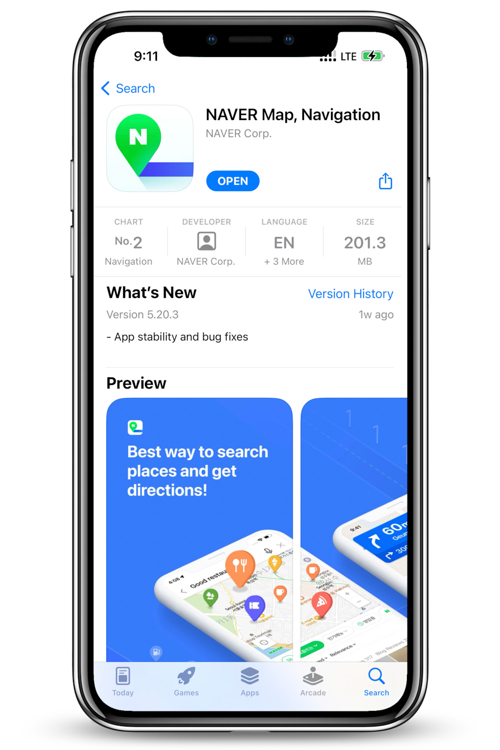
Naver Map is free; you can download it from either the App Store or Google Play Store. Users are allowed to use the app even without a Naver account. Normally, it is supposed to automatically respond to the device’s language settings. But if it doesn’t and a Korean default version appears, follow the steps below in order to change the language settings.
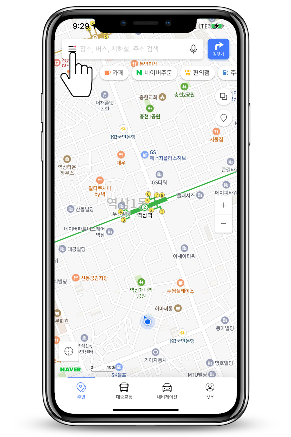
2. Change the Language
Tap on the three lines, next to the search bar on the left.
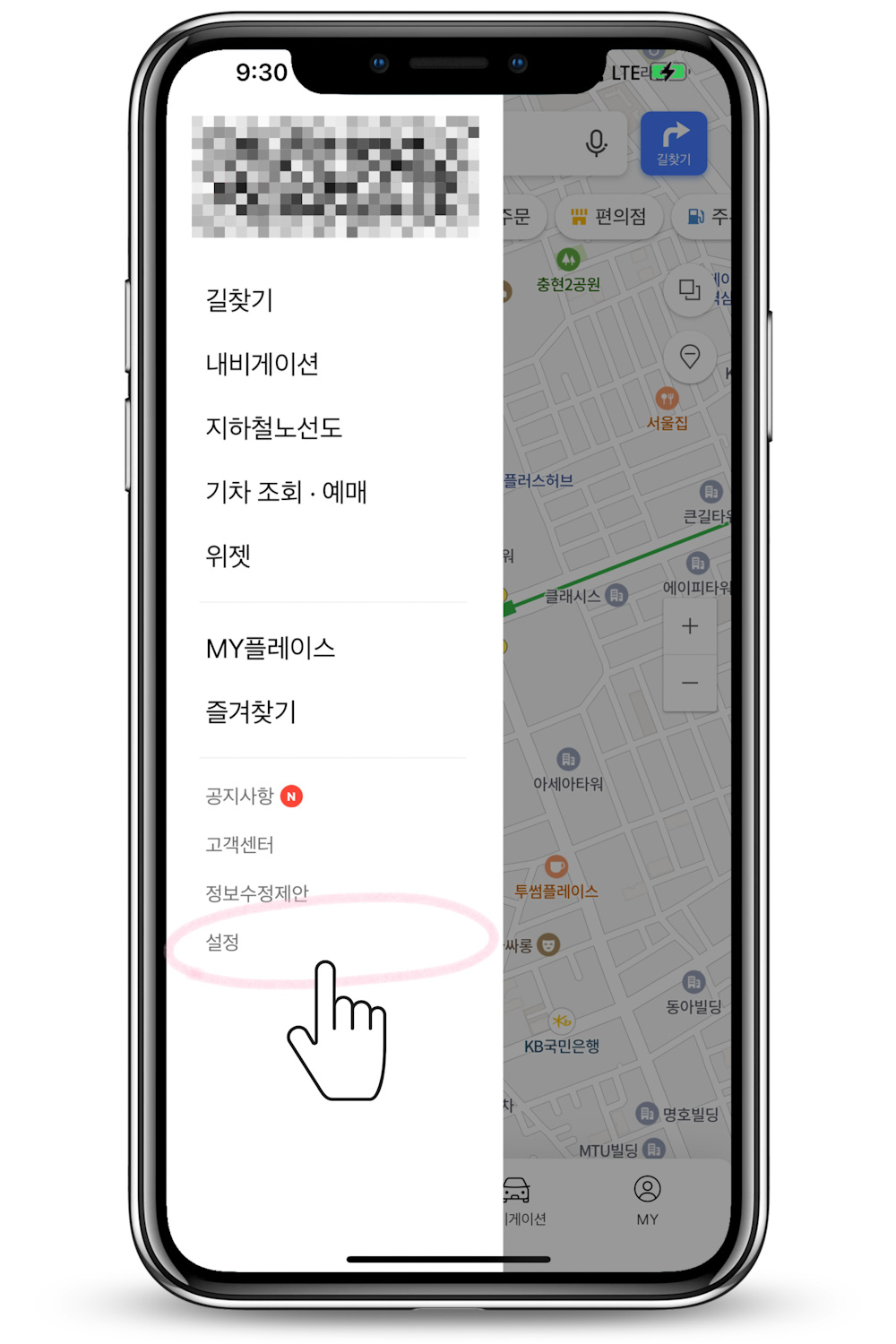
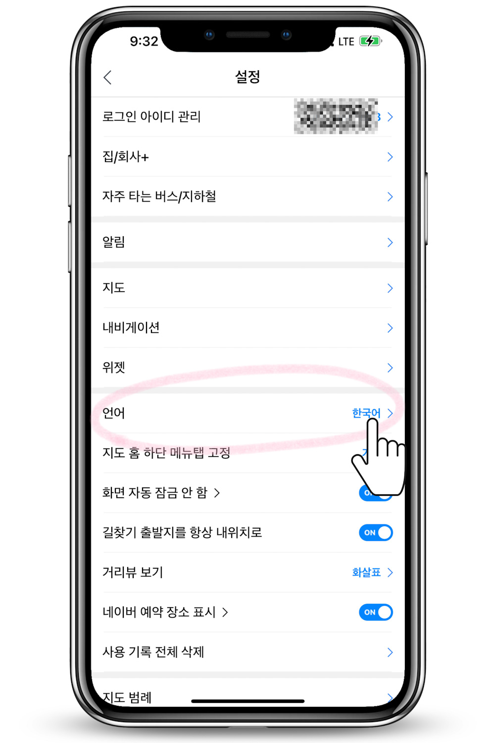
Select ‘설정’ meaning setting.
Tap on ‘언어’ which is language in Korean.
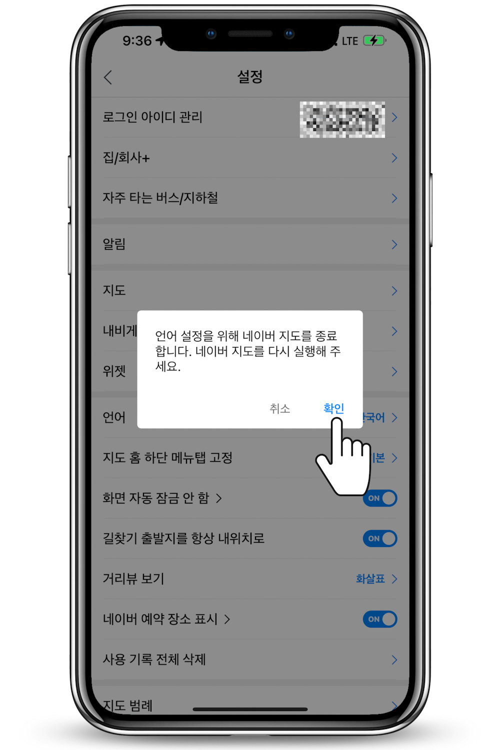
Select your language of choice. The availabilities are Korean, English, Chinese, and Japanese. Then, there should be a pop-up notifying you that ‘the app will close in order to apply the language, please restart Naver Map’. Select ‘확인’ to confirm.
3. Navigate
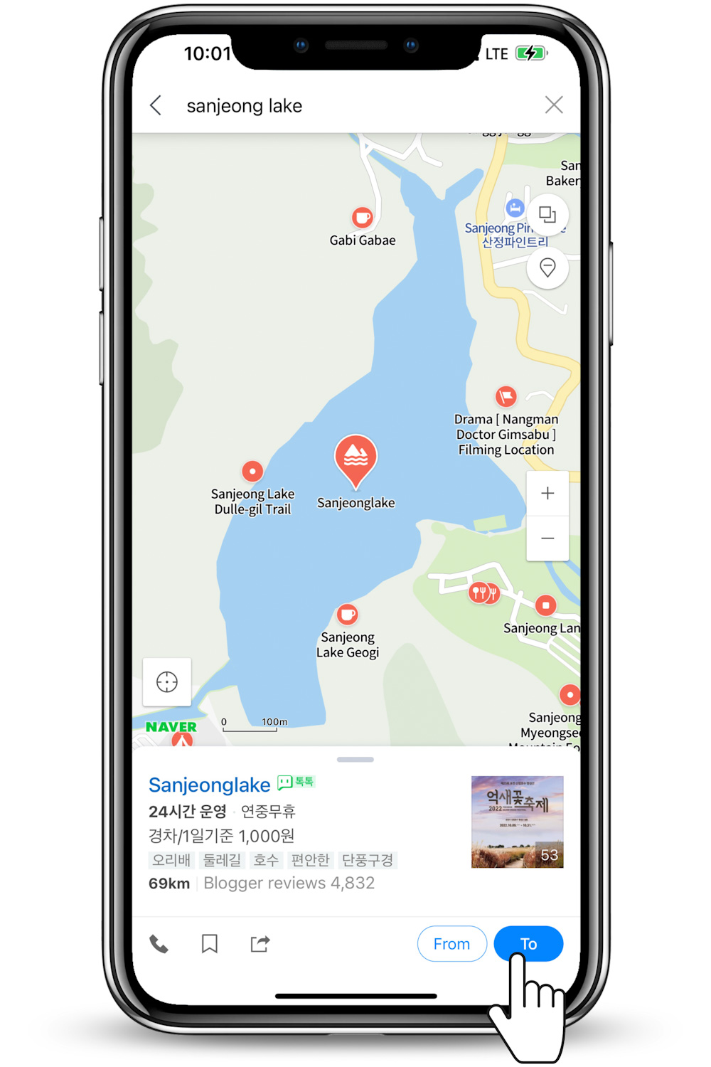
Now, in a hypothetical situation; say, you were browsing through my blog and getting interested in visiting Sanjeong Lake in Pocheon city for a winter getaway. You can either:
Scroll down until you hit the bottom of the post and tap on the link I embedded,
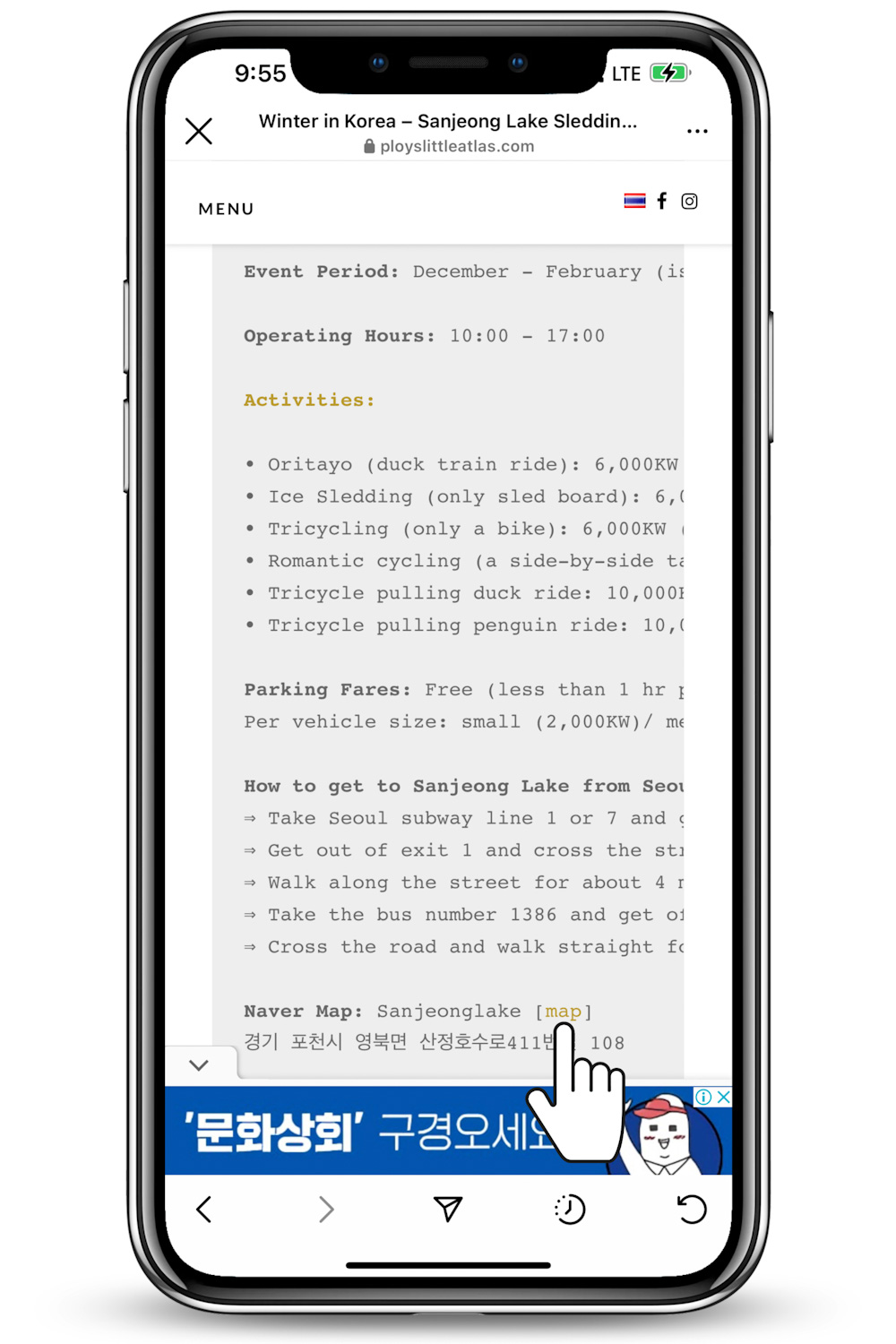
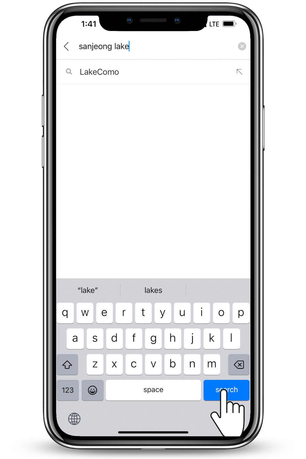
Or open Naver Map, then input ‘sanjeong lake’ or ‘산정호수’ in the search bar and click search. You can copy a Korean name of the location from my posts, if the app fails you with the English version; this is why I frequently bracket a set of Korean after places names.
After the destination is displayed, tap on ‘to’ button.
Naver Map will defaultly compute based on your current location. However, you can input a precise location in the ‘from’ field.
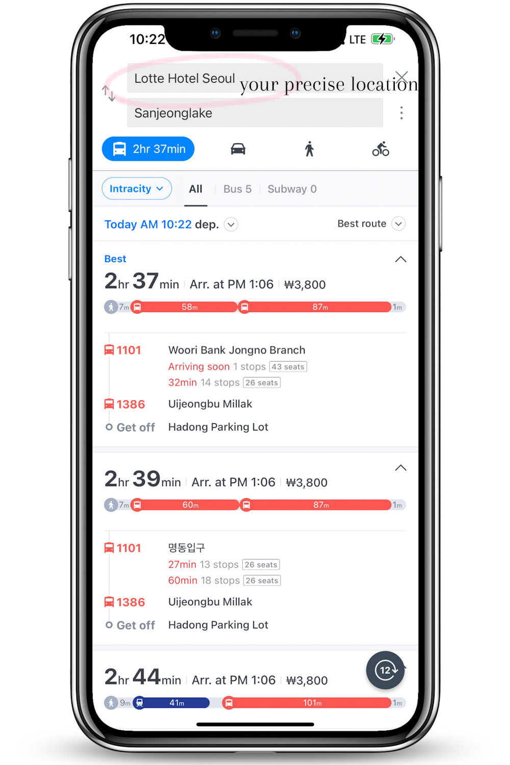
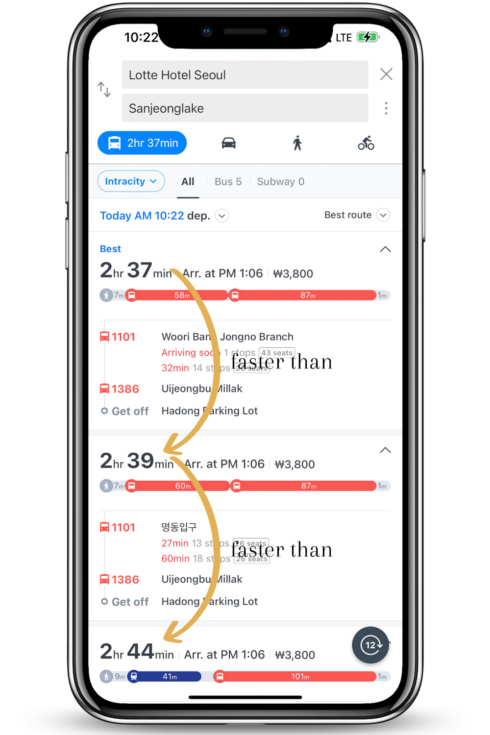
The app is likely to provide you lists of options with the least time-spent set of transport on top.
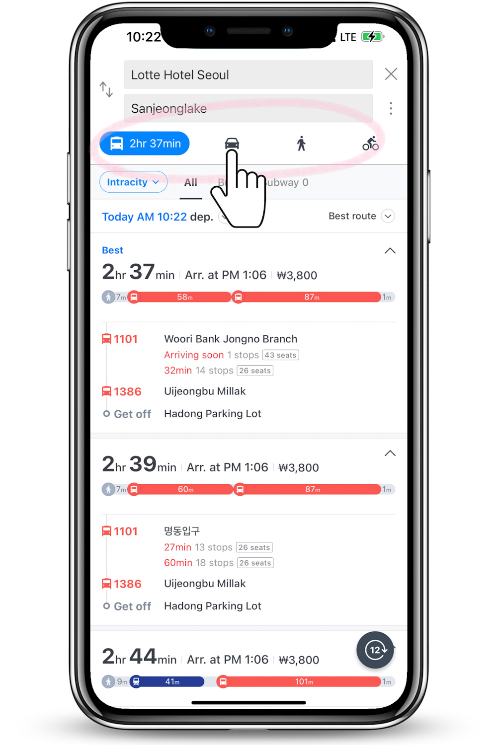
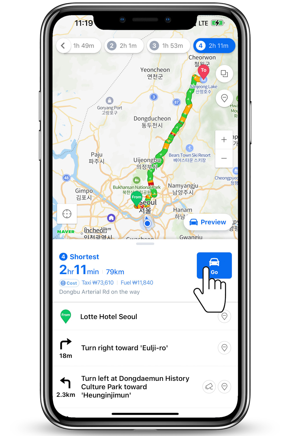
Now the next thing is to pick out your mode of transportation: public transportation, driving, walking, or bicycle. For instance, if you were up to a fun road trip from Lotte Hotel Seoul to Sanjeong Lake, you’d want to tap on a car icon.
You can select the quickest route or the ‘avoid tolls’ option, if you are driving there yourself. But if you’d opt to hop on a taxi cab, the app also provides you with how much amount of money you’d have to save up for a trip.
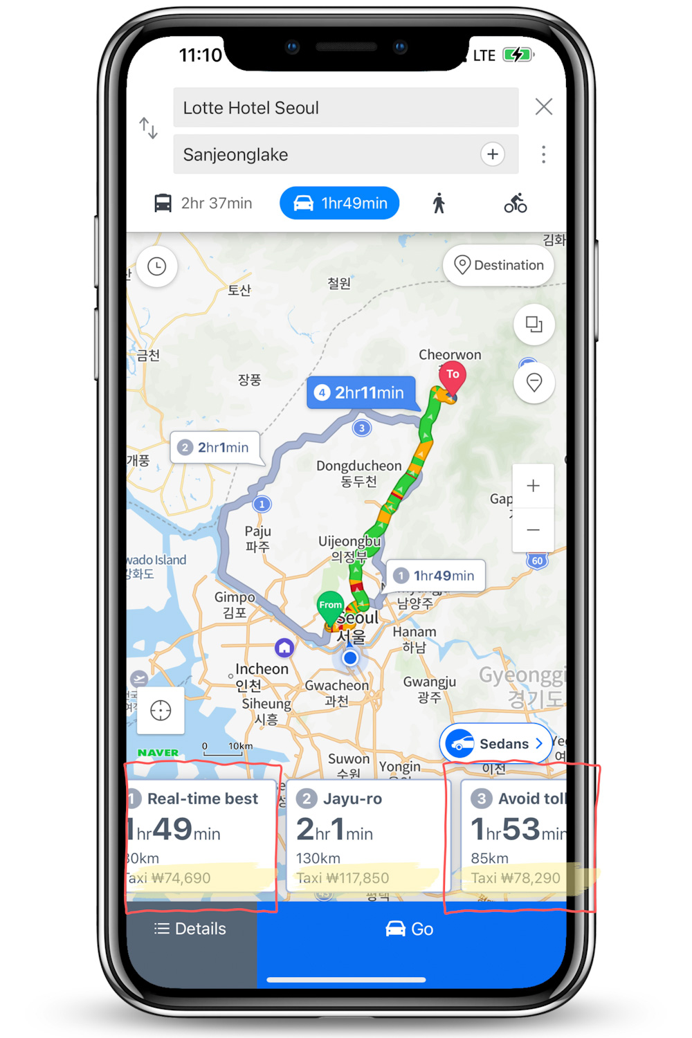
Once the route is selected, you can tap on ‘Details’ to see the detailed directions and select ‘Go’ to start the navigation.
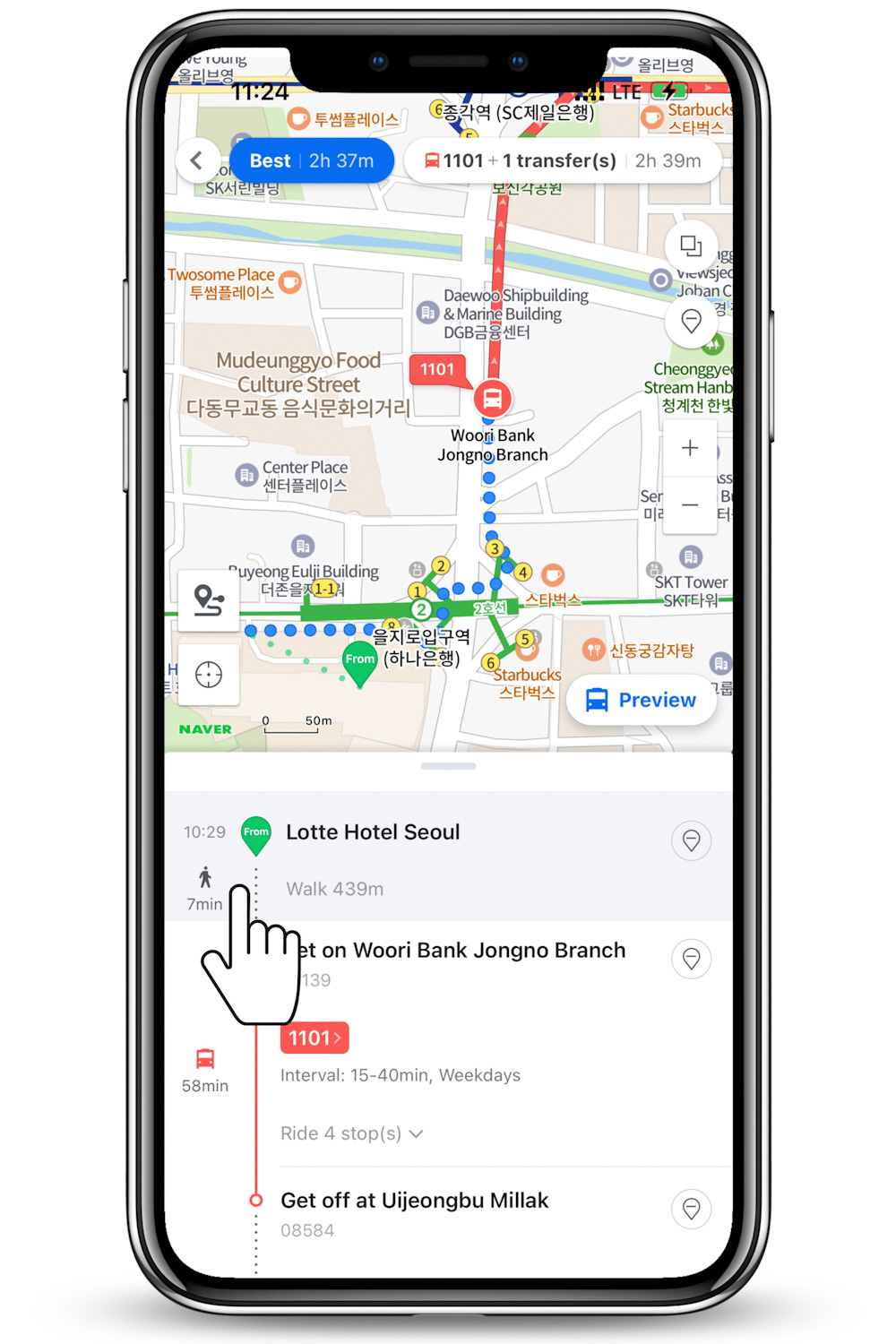
For the case of public transportation, after choosing the route you can tap on any part of the detailed instructions to get a bigger picture of the suggested direction.
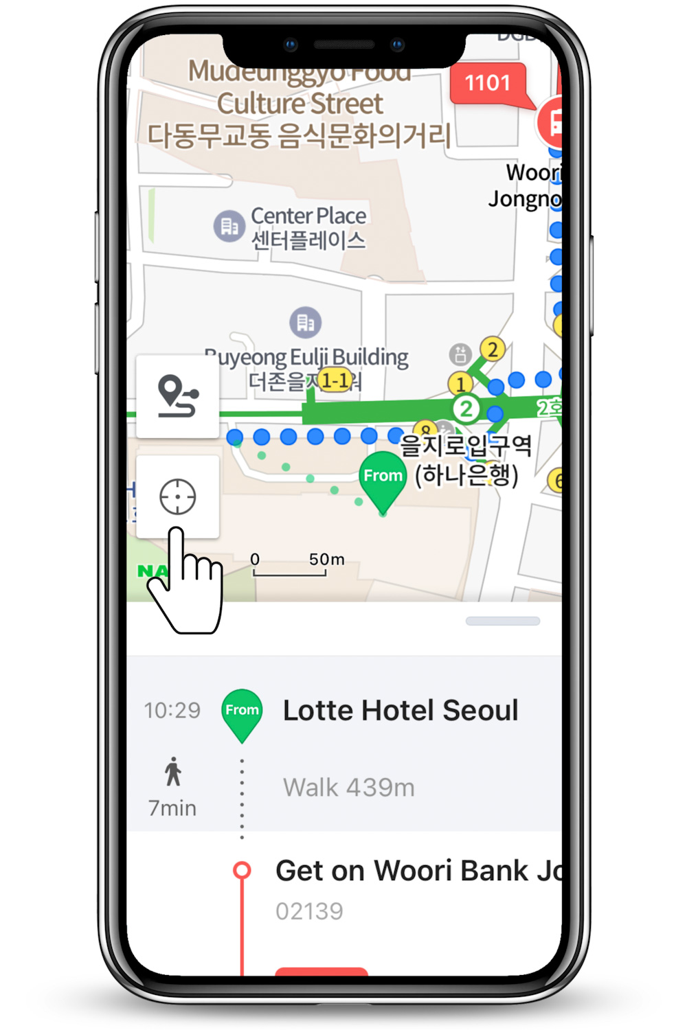
Pro Tip: Use the icon on the left corner of the map to track down your current location. Although Naver Map can suffice you with detailed directions and instructions, in many real situations it is not easy to stay on track; particularly when taking a bus is involved. Several bus routes, even in a big city like Seoul, don’t have announcements in English. A big piece of advice here is to often check where you are on the route that you selected. Be prepared if you are getting closer to the point you have to get off. Have your eyes on your location and stay connected.
Now you know the basic needs to navigate into any parts of Korea via Naver Map. I hope this will make your next time in Korea twice the fun. And if you keep digging deeper into features the app has, you will see that it is more than a mapping tool!
Other Korea Post You Might Like:
Did this entry help you? Or Did you enjoy my photos? Help support my small blog by giving a little cup of joe. I am always grateful when readers reach out wanting to support 🙂
p.s. This post is independently created. However, when you book or purchase something through the retail links, I may earn an affiliate commission to help keep Ploy’s Little Atlas running. Thank you very much for your support!
p.p.s All images used (unless specified) are owned by the author of the blog and permission is required for a repost. Please, reach out via social media channels to ask beforehand if you’d like to use them.
Last Update: January 30, 2025